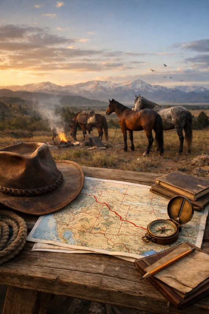
Quiet Miles Route Spine: From the Desert to the High Country
Some routes look clean on a map—straight lines, tidy turns, a beginning and an end you can tap with a fingertip. Ours doesn’t.
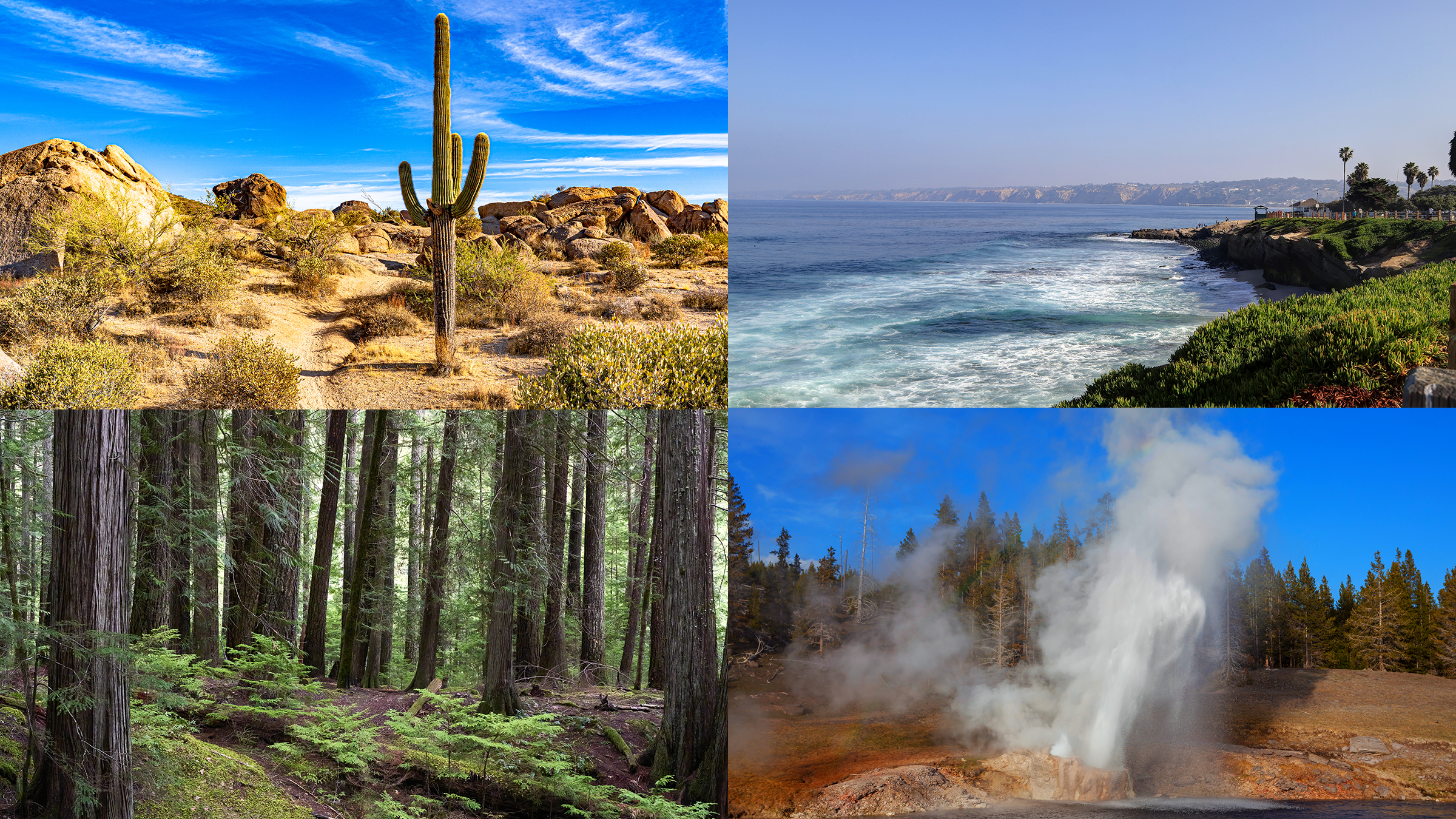
The Quiet Miles route spine starts at the desert edge in San Luis, Arizona. From there we reach for the California coast, swing inland toward Devil’s Garden, climb into the high country around Yellowstone, and keep going until the land opens up at the Montana border. It’s not the shortest way to anywhere. It’s the way that makes sense for the horses we’re riding, the public lands we’re trying to understand, and the story we’re trying to tell—one careful day at a time.
Because this isn’t a race. It’s a crossing.
And a crossing doesn’t let you be reckless—not with hooves, not with weather, not with the kind of miles you have to live with the next morning. When we make a choice on this route, I’m thinking about water, footing, heat, wind, and what a wild-born mind does when the world gets loud. (If you’ve ever heard a semi downshift beside a horse that’s trying very hard to be brave, you know what I mean.)
This spine also leaves room for what matters off the saddle. We’ll pause where it’s right—sometimes to recover, sometimes to listen, and sometimes to plant something living: a quiet act of gratitude in places that have carried us. The West gives a lot. I don’t want to take from it and disappear. I want to leave behind something that will last a long time. (More on that here: Roots Along the Quiet Miles
Trail Signs
Desert Line • Coast Turn • Devil’s Garden • Yellowstone Country • Montana Border
If you’re new and want the bigger picture of what Fading Hoofbeats is, start here: Start Here
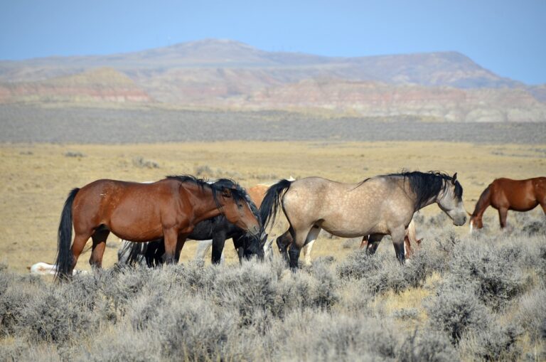
If you’re here for wild horse country—where to go, what to expect, and how to visit respectfully—head to: Wild Horse HMA Guides Hub
And if you want the day-by-day—miles, weather, camps, and what actually happened—follow: Trail Journals Hub
The Quiet Miles Route Spine (at a Glance)
I call it the route spine because everything else hangs off it—every side story, every mustang detour, every weather day, every “we need to stop here” decision that never shows up when someone draws a confident line on a map.
San Luis, Arizona → California coast → Devil’s Garden → Yellowstone → Montana border.
That’s the backbone. The legs and ribs are the unglamorous parts: where we can reliably resupply, where we can rest without drama, where the horses can recover, and where we can step off the trail long enough to plant something living—something small, local, and real.
It holds up the mission, too. This isn’t just about miles. It’s about the West that shaped the mustang, the public lands that still carry them, and the thin line between still wild and almost gone.
Why This Spine (and Why It Isn’t Straight)
People ask why we don’t just point north and go.
The honest answer is that the “straightest” route is almost never the kindest route.
Long rides don’t usually fail on the dramatic days. They fail on the quiet ones—when you push past the point of sense because you’re chasing a number, when you miss a water plan by “just a little,” when you tell yourself a horse is fine because you want them to be fine.
So, this route is built around three things I’m not willing to negotiate.
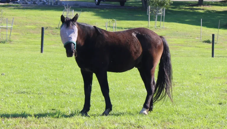
1) The Horses Come First
Floki and Lagertha aren’t props. They’re partners. And they’re not machines—legs, hooves, backs, hydration, digestion, and minds all get a vote in whether this works.
So, the spine has to leave room for pacing that protects joints and feet, rest that isn’t treated like failure, resupply corridors often enough that we’re not forced into bad decisions, and flexibility that allows the ability to pause, reroute, shorten a day, or stay put when conditions aren’t favorable for progress.
The goal isn’t “How fast can we go?” It’s “How long can we keep the horses feeling eager and willing to go forward?”
2) The Land and Its Rules Matter
Public land is a patchwork—different agencies, different seasons, different closures, wildlife realities, and local pressures. The West has places that welcome you, places that tolerate you, and places that will punish you if you act like you own them.
So, the route is built assuming we’ll have to adjust for the following factors:
• fires that may detour us
• closures that may stop us
• weather that may force holds
• the “best” plan on paper may turn into the worst plan in real life. We have to be flexible and alert to needs of the moment.
3) The Story Has to Be Followable
A route that only makes sense to the people riding it isn’t much use to readers. This spine keeps the whole project readable, Overview posts explain the why; trail journals show what actually happened; and guides answer the question, “If you want to visit, how do you do it respectfully?” After the long ride is over, a recap will summarize the trip so you can recreate the route (or a similar one) so that you can live your own adventurous long ride across the wide-open western states.
Desert Line: San Luis, Arizona
San Luis is where the route stops being an idea and becomes a discipline.
In the desert, morning comes in quietly—thin light at first, then a widening band of gold that makes every rock look sharp-edged and somehow more than 3D. The air can feel almost soft for a moment… and then the sun climbs and you remember: softness isn’t part of the contract out here.
This is where we start because a long ride has to begin with humility. The desert doesn’t reward bravado. It rewards the planning nobody sees in photos: water math, timing, and the willingness to stop early when early is the safest choice.
Here’s what we’re watching right away:
• Water, but not just “do we have it”—how often we can refill, how far we’re willing to ride between known points, and what the backup plan is if one point doesn’t pan out.
• Heat rules are not optional: early starts, midday holds, shorter days when needed. Making miles is never worth making a horse miserable.
• Footing and hooves: dry ground can be hard as concrete. The horses don’t need “toughening.” They need steady conditioning, conservative mileage builds, and attention to small soreness before it becomes big soreness.
And then there’s the part you can’t spreadsheet.
The desert line teaches you to listen. The horses become your truth-tellers. If they’re bright-eyed and swinging forward, you keep going. If they get dull, or tight, or quiet in that way that means I’m working too hard, you stop. No bargaining. No “just a few more miles.” No way, no how, no excuses. Horses come first, full stop.
This is where the Quiet Miles earns the name.
Coast Turn: The First Big Reset
Reaching the Pacific isn’t just a milestone photo. It’s a reset point.
The coast has its own mood—cool air that tastes faintly like salt, mornings that can arrive wrapped in fog, wind that can carry a chill even when the sun is shining. For a horse that’s been living in sharp desert light, the coast can feel like another planet. Sounds bounce differently. Sights arrive in layers. And the human world presses closer, which is perhaps most important from a mustang point of view.
The practical reality is that “nature” and “civilization” braid together here. That brings benefits—more services, easier resupply—but it also brings pressure in the form of more roads, more fences, more dogs, people, vehicles, more everything scary. Scariest of all perhaps, more well-meaning strangers who don’t realize a traveling horse needs space, and a mustang isn’t a circus pony that is okay with excitement and fanfare.
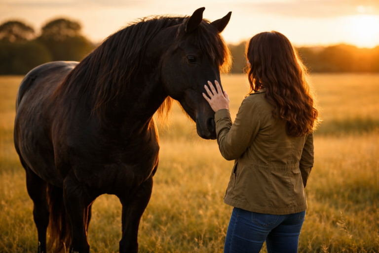
So, the plan shifts. We watch for mental fatigue as much as physical fatigue, and we build days around calmer travel windows, deliberate breaks, safer places to step off the edge of the busy world, and routines that keep the horses confident when the environment is… a lot. This is where the trust we’ve built with the horses comes into play. When we ask them to trust us as chaos builds around them, we better have a good basis for that trust, or the ask won’t get the response we hope for.
The coast can be breathtaking. It can also be loud. This is where trust becomes visible—not the dramatic, viral kind of trust, but the kind that looks like a horse blowing out a breath and choosing to keep walking beside you anyway.
Devil’s Garden: Mustang Country Pulls Us Home
Devil’s Garden isn’t just a waypoint. It’s a cornerstone.
There’s a difference between writing about mustangs and traveling toward the places that made them. Devil’s Garden carries weight because it isn’t just scenery—it’s history: of land, policy, controversy, and endurance.
This is where the project shifts deeper into mustang country—less concept, more connection. Less general talk. More specifics.
And yes, this leg can turn into a chess game. Resupply isn’t evenly spaced. Weather can get rough faster than people expect. There are stretches where “we can figure it out” turns into “we should have already had it figured out.” This is the point where we plan around feed access (forage isn’t guaranteed just because it’s rural), farrier timing (staying ahead of hoof wear and traction needs), recovery days (building strength is one thing; maintaining willingness is another). This is the point where we are far enough into the journey that the horses are falling into the routine of the days and the pulse of the breaks. It’s also where we need to pause and take stock of how the ride is going overall.
This is also where the HMA/WHT Guides stop being a sidebar and start feeling like part of the bones of the project. We can connect readers to the bigger picture—where wild horses still live, what pressures those herds face, and what respectful visitation looks like. If the desert teaches discipline, Devil’s Garden teaches devotion.
Yellowstone Country: When Weather Becomes a Character
From here on, season stops being background.
The high country has a way of changing its mind. A morning can start clear and bright, and by afternoon the sky has built a wall. Temperature drops. Wind arrives. The land reminds you it’s not here to be convenient.
This is where the route spine becomes less about ambition and more about judgment.
We plan for weather windows because sometimes the smartest mileage is no mileage; elevation pacing because lungs and legs work differently up high; shorter, steadier days when needed; and enough margin in the schedule so a hold doesn’t become a crisis. The high country is not the place to discover you don’t have a backup plan.
Yellowstone country carries a kind of awe that doesn’t invite bravado. It invites quiet. It invites the kind of respect that changes how you move—how you camp, how you pass through, how you leave no trace (Leave No Trace principles), how you keep your horses safe without acting like the world owes you comfort.
It’s one of the places where the name Fading Hoofbeats feels painfully accurate: the beauty is immense, and the responsibility is, too.
Montana Border: Big Country, Big Rules
The closer we get to the border, the more the route starts to look like what people imagine when they think “West”: sky that won’t quit, distances that stretch your sense of scale, and the kind of quiet that makes your own thoughts sound startlingly loud.
But big country comes with big rules. This is where we get most conservative, because help can be far away, weather can be sudden, wildlife can be close, and complacency is dangerous.
We’ll be thinking about travel timing, safe camping and rest, managing “easy” miles so they stay easy, and keeping the horses comfortable—not merely moving.
By the time we reach the border, we won’t be thinking about what we took from the miles. We’ll be thinking about what the miles asked of us, and what we were able to leave behind that’s quiet, local, and alive.
And when we arrive, it won’t feel like a finish line. It’ll feel like a clean pause—a place to look back at what we did right, what we learned the hard way, and what we need to change before the next spine continues. Because long rides don’t end in triumph. They end in gratitude—for sound horses, for good decisions, and for the fact that you made it through the hard parts without losing what mattered. We’ll probably be done at this point, but there’s a slim possibility of a ride back down the Western Slope of the Rockies to the Mexican border.
How to Follow Along (So It Stays Easy)
To keep this journey readable and useful, we publish in layers:
- Overview posts (like this one)
Big picture. Why the route is shaped the way it is. - Trail journals
The day-by-day truth: miles, weather, camps, wins, setbacks, real trail life.
→ Trail Journals Hub - Practical trail notes
Water, footing, resupply, closures, permits, and “what I’d do differently.” - HMA/WHT guides
Where wild horses live nearby and how to visit respectfully.
→ HMA Guides Hub
If you want the simplest entry point, start here: Start Here
Then pick a leg from the trail signs above and come with us.
A Note on Conditions and Closures
Trail conditions change. Closures happen. Fire season rewrites plans. Storms wash out the best path and force rerouting.
We’ll always share what we know, but nothing here should be treated as real-time permission or official guidance. If you’re traveling any part of this route yourself, always check current managing agency updates first.
The Heart of the Spine
If I had to say it in one sentence, it would be this:
We’re riding a route that makes sense for the horses, honors the land, and tells the story honestly—even when honest means slow.
Start here: Start Here
Wild horse travel + respectful visits: HMA Guides Hub
Day-by-day trail truth: Trail Journals Hub
And if you want a little entertainment to sustain you until the ride, check our Trail Breaks, a series of fun puzzles and games to pass the hours: Trail Breaks
FAQ
What do you mean by “route spine”?
I call it the route spine because it’s the backbone everything else hangs off—every side story, every detour into mustang country, every weather day, and every practical decision that doesn’t show up when someone draws a confident line on a map. The spine is the big picture: San Luis, Arizona → California coast → Devil’s Garden → Yellowstone → Montana border.
Why not take the straightest route north?
Because the straightest route is rarely the kindest route. This ride is built around what keeps horses sound and willing: water planning, safe footing, heat and wind rules, recovery days, and the flexibility to pause or reroute when conditions demand it. We’d rather arrive later than arrive with a horse that’s sore or overwhelmed.
How can I follow along without reading every post?
Start with the hubs and pick what fits your mood. For the big picture, begin with Start Here . For wild horse travel and respectful visits, use the Wild Horse HMA Guides Hub. And for the day-by-day miles, weather, camps, and real trail truth, follow the Trail Journals Hub.
Will you share the full route and logistics later?
Yes. As the project grows, we’ll publish leg-by-leg overviews, trail notes (water, resupply, closures, and what we’d do differently), and eventually a recap that ties the whole route together—so you can recreate it, or build your own version of a long ride across the West.

Can you show us the route on a map? It would be interesting to have a broader visual overview of the plan.